
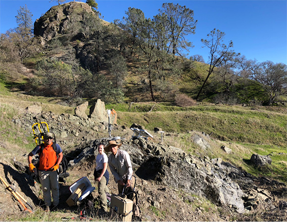
From the left: Noah Finnegan (UC Santa Cruz, PI), Colleen Murphy (UC Santa Cruz graduate student), and John Galetzka (UNAVCO) with cGPS site ORE3 in the background. (Photo/Dylan Schmeelk, UNAVCO) 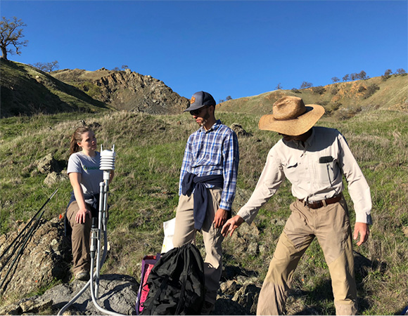
UC Santa Cruz PhD student Colleen Murphy, UC Santa Cruz PhD candidate Alex Nereson, and John Galetzka gather around the MetPack at the ORE3 cGPS station to discuss logistics for the remaining work days before hiking back to the truck. (Photo/Dylan Schmeelk, UNAVCO) 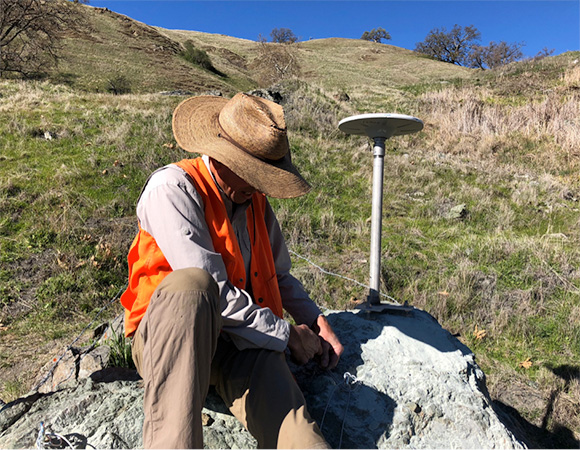
UNAVCO Project Manager John Galetzka anchors the GPS enclosure to a boulder at the ORE2 cGPS station. (Photo/Dylan Schmeelk, UNAVCO) 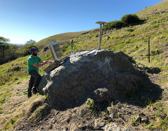
UNAVCO Engineer Dylan Schmeelk performs final tests on the communication systems at the ORE2 cGPS station. (Photo/John Galetzka, UNAVCO)
Project Overview
From February 12th through 16th, UNAVCO’s Dylan Schmeelk and John Galetzka joined UC Santa Cruz professor of Earth and Planetary Sciences Noah Finnegan (PI) and his graduate students Alex Nereson and Colleen Murphy in Oak Ridge in the mountains just east of Milpitas, CA to upgrade continuous GPS (cGPS) monitoring of the slow slip landslide at Oak Ridge Earthflow Observatory. The upgrade included two new cGPS sites (ORE2 and ORE3), a Vaisala weather station, communication systems to allow for remote data collection, and a power system upgrade to support the new equipment (at existing site OREO).
Significance
One of the key problems to understand in landslide mechanics and hazard prediction is why some landslides happen quickly, whereas other landslides slip slowly. The installation of cGPS at the Oak Ridge Earthflow Observatory is part of an ongoing project led by Noah Finnegan to study the complex interactions between groundwater flow and the deformation of the slow slip landslide located upstream of the Calaveras Reservoir.
Challenges
The slow moving landslide that OREO, ORE2 and ORE3 cGPS stations are monitoring is located nearest to the Calaveras Fault Zone, and mere miles from the intersection of the Mission and Arroyo Aguague faults, with the Hayward Fault Zone just to the west. Thus, the stations had to be engineered to withstand small, sudden movement of the landslide during seismic activity. Other engineering challenges included designing the cGPS stations to accomodate changes in groundwater pore pressure and to keep the bovine vandals from damaging the equipment.
Project Information
- Principal Investigator: Noah Finnegan
- UNAVCO Engineers: Dylan Schmeelk and John Galetzka
- Dates: February 12 – 16, 2018
- Location: Milpitas, California
- Funding Source: NSF-EAR
- Map of Calaveras Reservoir, California
Related Links
Written by:
- Dylan Schmeelk
- Posted: 23 May 2018
- Last updated: 4 June 2021
- Tags: GPS/GNSS, project highlights
-

