
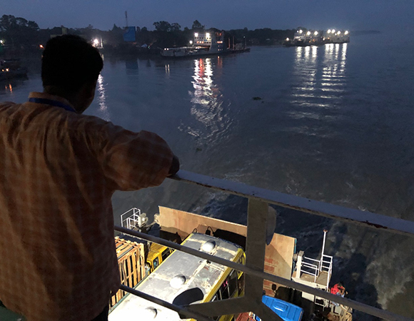
Taking the ferry across the confluence of the Ganges and Brahmaputra Rivers. (Photo/John Galetzka) 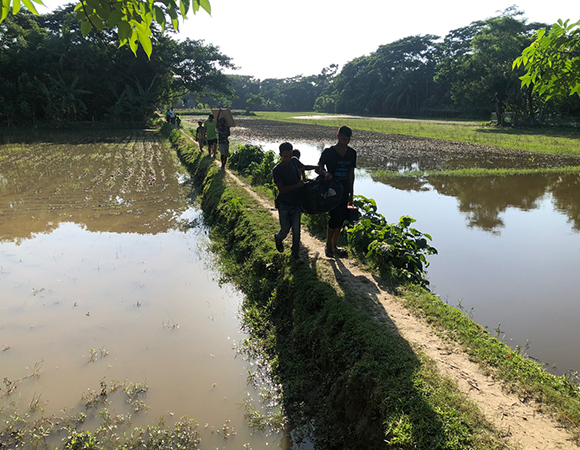
Villagers from Sonatola help the team move equipment to the proposed GNSS station and RSET sites.(Photo/John Galetzka, UNAVCO) 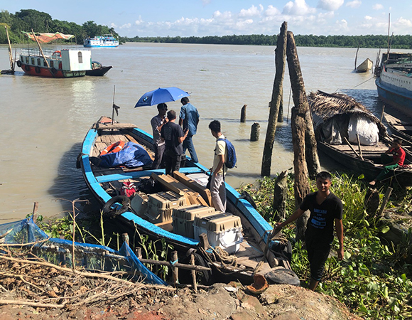
The GNSS equipment crew caught up with the Bawali (the white and blue boat in left background) (Photo/John Galetzka, UNAVCO) 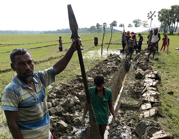
In this photo Sonatola villagers pause for a photo as they quickly cut a surprisingly deep trench between the GNSS monument and the equipment enclosure. (Photo/John Galetzka, UNAVCO) 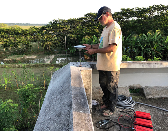
Mike Steckler installing the GNSS antenna on the SNT1 monument atop Sonatola Primary School. (Photo/John Galetzka, UNAVCO) 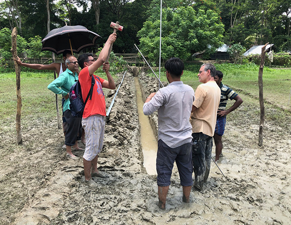
The GNSS team (Mike Steckler, Sanju Singha, Shaikh Nahiduzzaman, and Salam Sikder) installing the modified stainless steel GNSS monument. (Photo/John Galetzka, UNAVCO) 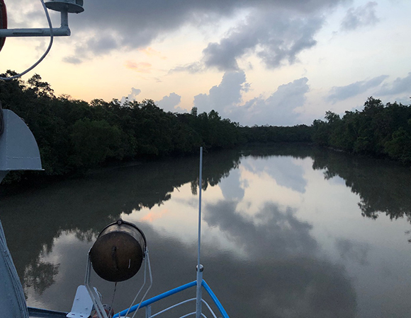
View looking off the bow of the Bawali as it travels on a tide channel in the Sundarbans in the early morning hours. (Photo/John Galetzka, UNAVCO) 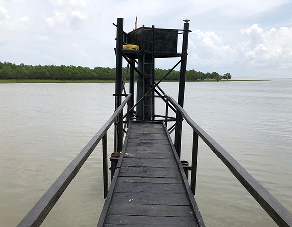
The GNSS team put a GNSS monument on the tide gauge structure at Hiron Point. (Photo/John Galetzka, UNAVCO) 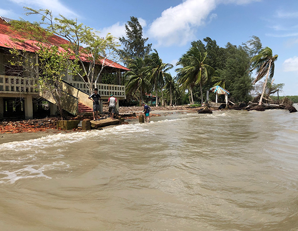
Facing the Bay of Bengal, the Sarangkhola ranger station in the Sundarbans is slowly being washed away because of rising sea level and subsidence of the delta. (Photo/John Galetzka, UNAVCO) 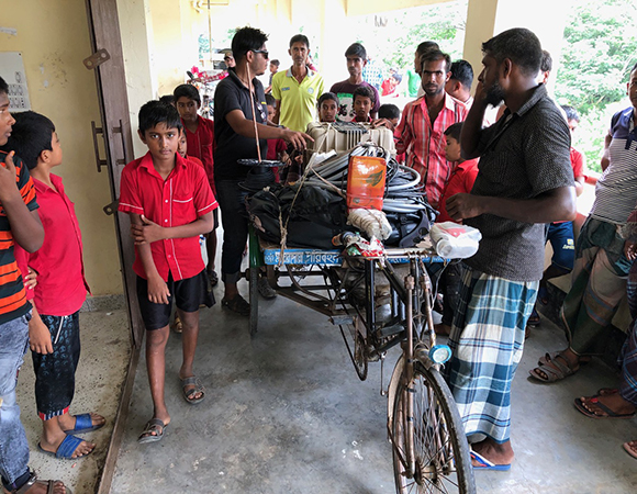
Sanju Singha (center with sunglasses) unloads a tricycle rickshaw of equipment brought from the cargo boat one kilometer away to the Baintala Primary School. (Photo/John Galetzka, UNAVCO) 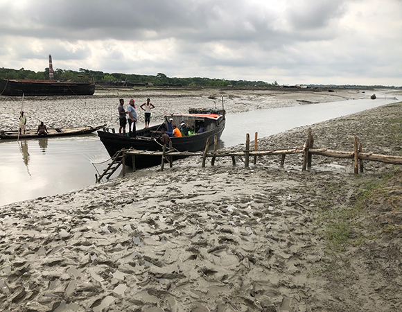
The upper reaches of tide channels became too shallow for the Bawali charter boat, so the team hired a smaller cargo craft close to a village named Baintala. (Photo/John Galetzka, UNAVCO) 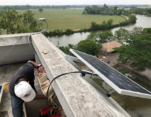
Sanju Singha putting the finishing touches on the new BNTL GNSS station atop Baintala primary school and cyclone shelter. (Photo/John Galetzka, UNAVCO) 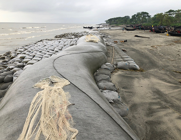
Long, giant sandbags along the coast of the Bay of Bengal at Kuakata, Bangladesh try to slow land erosion caused by subsidence of the delta and sea level rise. (Photo/John Galetzka, UNAVCO) 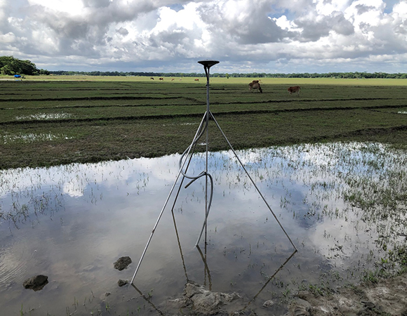
Photo of the completed Sonatala Two (SNT2) geodetic monument. (Photo/John Galetzka, UNAVCO) 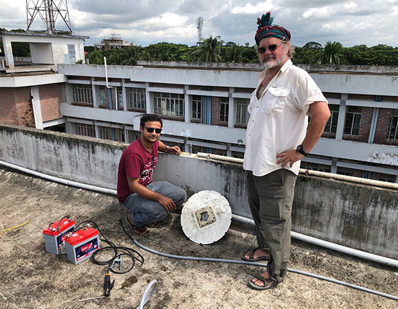
Hasnat Jaman and Chris Small remove a damaged GPS antenna and prepare for some battery welding on the PUST monument. (Photo/John Galetzka, UNAVCO) 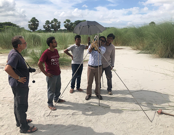
Mike Steckler (left), Hasnat Jaman (maroon shirt) and Sanju Singha (right) look on as Alamgir Hosain learns how to install a braced geodetic monument on the campus of Barisal University. (Photo/John Galetzka, UNAVCO) 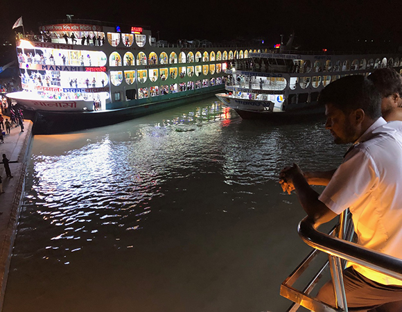
Giant river ferries prepare to take passengers from Barisal to Dhaka on an overnight journey—a truly world class way to travel. (Photo/John Galetzka, UNAVCO)
Project Overview
Farming in coastal Bangladesh relies on polders, low-lying tracts of land enclosed by earthen embankments that protect the land from tidal surges. In a dynamic deltaic environment and a changing climate, the polders are under threat. Factors influencing long-term stability of polders include subsidence, sedimentation, river migrations, flooding, storm surges, and sea level rise.
Through the project “Long Term Monitoring, Research and Analysis of Bangladesh Coastal Zone (Sustainable Polders Adapted to Coastal Dynamics),” researchers are examining these factors and the long-term management and design of the polders. The geodetic component of the project includes new continuous GNSS to monitor subsidence, co-located with Surface Elevation Tables, to ground truth InSAR measurements. Data will be incorporated into dynamic river system models at multiple scales of resolution and development of designs for sustainable polders.
UNAVCO Support
Mike Steckler and John Galetzka were assisted by students from Dhaka University (Sanju Singha, Samiul Alim, Masud Rana), faculty from Barisal University (Hasnat Jaman, Alamgir Hosain), and staff from the Institute of Water Management (Salam Sikder, Shaikh Nahiduzzaman) to install four new continuous GNSS stations, and refurbish five older ones during this particular journey to the world’s largest river delta—the Ganges-Brahmaputra-Meghna Delta.
Project Information
- Principal Investigator(s): Mike Steckler, Lamont-Doherty Earth Observatory, Columbia University
- UNAVCO Staff: John Galetzka
- Dates: July 16 – August 7, 2019
- Location: Bangladesh
- Funding Source: The World Bank
- Map of Bangladesh
Related Links
Written by:
- Mike Steckler, John Galetzka, and Beth Bartel
- Posted: 26 March 2020
- Last updated: 4 June 2021
- Tags: GPS/GNSS, project highlights
-

